During its participation in a war of nine months of hostilities, 101 Squadron
sure moved around. Bases it used include Chatzor, Ekron, Herzliya, and Netanya.
Anyone familiar with the history of the place and era already knows that base
and town names shifted just as frequently. Each airbase, to take an example
that's particularly relevant, had an RAF name, an Arab name, and a Hebrew name
- and even some of the Hebrew names change over time. To maintain a contemporary
standard, Israeli bases are referred to by their original Israeli designations.
The first S-199s to arrive in Israel arrived inside C-46s at Ekron, as part
of Operation Balak, and were assembled there. 101 Squadron stayed at Ekron until
a June 1 REAF Spitfire raid on that field damaged a pair of S-199s awaiting
assembly in a hangar. The effectiveness of the raid, and the revelation that
Egypt knew where Israel based its fighters, convinced the air force to pull
the unit back from the front lines and move it north. Native sons Modi Alon
and Ezer Weizman chose the new destination, Herzliya. It had a 2,000-m unpaved
runway bulldozed into the terrain amid orange groves. Weizman claims that one
of the reasons they chose this field was because they felt the unpaved strip
would handle the uppity Avias somewhat better than concrete, but Syd Cohen believes
the softer surface actually promoted accidents. The REAF never attacked the
Herzliya field, possibly because they never knew any aircraft were based there.
The aircraft were nestled between orange trees beneath camouflage netting -
apparently successfully hidden, as Herzliya was never targeted by enemy air
attacks. A water tower - which still stands - served as the control tower.
The actual move to Herzliya from the original base at Ekron took place shortly
after Alon shot down two REAF Dakota bombers on June 3 - probably during between
June 4-6.
At the same time, the Central Maintenance Unit - the guys putting together
and repairing the S-199s - moved from Ekron to an airfield at Kibbutz Ma'abarot,
next to the Netanya airfield.
 In
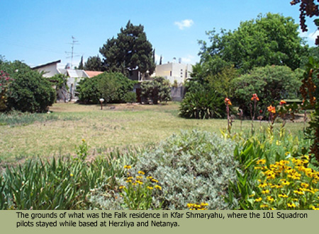
late July, renovation at Herzliya forced the 101 to move to Netanya, where it
stayed until Aug. 26. Although the planes and equipment transferred to Netanya,
the pilots remained at their quarters in Kfar Shmaryahu, where they stayed while
based at Herzliya.
In
late July, renovation at Herzliya forced the 101 to move to Netanya, where it
stayed until Aug. 26. Although the planes and equipment transferred to Netanya,
the pilots remained at their quarters in Kfar Shmaryahu, where they stayed while
based at Herzliya.
On Nov. 9, with the Negev front the focus of the war and the Egyptians having
retreated beyond striking range of the southern airfields, 101 Squadron moved
to Chatzor, where it stayed for the duration of the conflict. [START HERE]
I have been unable to find a good period map showing the relationship between
the battlefront and the air bases. I have, however, found a modern IAF
map that shows most of the 1948 bases - Netanya is the notable exception.
I also found some declassified period maps in the public domain at the Web site
of the Harry S. Truman
Library and Museum (yes, they use "S." not "S" - I don't
know why). One map shows the disposition of forces at the June 11 ceasefire,
and the other is a map of the situation in April 1949.
The June 11 map is
hard to read, but look at the tenuous link connecting the southern forces with
Tel Aviv. You can really get a feel for the importance to the Israelis of maintaining
secure air lanes to the Negev.
I put red dots on the 1949
map next to the names of places important to the 101's story. Look for the
bases at Netanya (Natanya) and Kfar Sirkin (Petach Tikvah) and the targets of
Al Arish, Gaza, Majdal (El Majdal), Faluja (El Faluja), and Isdud. Note that
the dots only call attention to the names and do not indicate the exact locations.
Information on each of 101's bases follows. The fields will be designated by
the Hebrew name during the 1948-49 war and the RAF base name (if applicable),
in that order.
Ekron/RAF Aqir
Now known as Tel Nof, the base entered RAF service in 1941 and Israeli service
in May 1948. Tel Nof has become the major IAF base.
ICAO code: LLEK
Location coordinates: N31 50 E034 50
Elevation: 295 ft (90 m).
Three runways: 15/33 of 9,022 ft (2,750 m) length, 18/36 of 9,022 ft (2,750
m) length and 09/27 of 6,004 ft (1,830 m) length
The REAF attacked Ekron June 1, while the 101 was stationed there
Chatzor/RAF Qastina
The RAF finished construction on Qastina in 1945. Israel took control of the
field November 9, 1948. This airbase serves as the current home of 101 Squadron's
F-16s. In 1948, the base consisted of two crossing concrete strips, a small
control tower, and ramshackle barracks, located some 20 miles southeast from
downtown Tel Aviv. In winter, the desert airfield grew cold at night. Red Finkel
recalls placing three kerosene heaters under his bed and crawling under the
blankets while wearing all his clothing.
ICAO code: LLHS
Location coordinates: N31 46 E034 44
Elevation: 121 ft (37 m).
Two runways 05/23 of 7,986 ft (2,434 m) length and 16/34 of the same length
Herzliya/-
Israeli construction workers built this airstrip specifically for 101 Squadron.
At the time, the field sported a 2,000-yard unpaved landing strip of compressed
mud and sand. Now also known as Kfar Shmaryahu, the airport now primarily serves
Israel's general aviation community, including many civil flight schools and
air-taxi operations.
ICAO code: LLHZ
Location coordinates: N32 10.8 E034 50.1
Elevation: 121 ft (37 m)
One runway: 11/29 of 3,291 ft (1,003 m) length
Netanya/-
Also known as Kfar Hayim, this strip is now used by agricultural aircraft.
ICAO code: ?
Location coordinates: ? East of Netanya (town)
Elevation: ?
One runway: ?
Sde Dov/-
Established in September 1938 as a civil airport for Tel Aviv, it closed in
the summer of 1940 because of the war. The Jews re-opened the field in December
1947 and used it primarily for the Sherut Avir. Currently home to five IAF squadrons.
ICAO code: LLSD
Location coordinates: N32 07.0 E034 46.9
Elevation: 43 ft (13 m)
One runway: 027/207 of 5,712 ft (1,741 m) length (shorter in 1948)
Kfar Sirkin/RAF Petah Tiqva
Completed in 1941 and used by the RAF until May 1948. Les Shagam was to have
formed 105 Squadron with the Velveta Spitfires here, but the threat of Arab
artillery ended those plans. Now serves as Sirkin, headquarters for the IDF/AF
air defence branch.
ICAO code: ?
Location coordinates: N32 04 E034 56
Elevation: 164 ft (50 m)
Two runways: 14/32 and 10/28 , each of 4,003 ft (1,220 m) length
Ramat David/RAF Ramat David
The RAF finished construction in 1942. Egypt bombed and strafed the field repeatedly
on May 22, 1948 and the RAF left for good the next day. Israel moved in May
26. Currently, four IAF squadrons call Ramat David home.
ICAO code: LLRD
Location coordinates: N32 40 E035 11
Elevation: 138 ft (42 m)
Three runways: 145/325 of 8,005 ft (2,440 m) length, 105/285 of 9,022 ft (2,750
m) length and 085/265 of 9,022 ft (2,750 m) length

Of course, several European airbases also played their parts in 101's story.
Chief among these was Zatec (pronounced ZHAtess), Czechoslovakia. Gordon Levett
describes it as it appeared when he arrived in April 1948:
In an isolated and rural area about 20 miles from the East
German border we turned onto a minor road leading to a military aerodrome....
The aerodrome was primitive with a control tower, a few huts and a single
concrete runway. It had been used by the Luftwaffe as a fighter base during
the Second World War.
When the tarmac came into view I saw an astonishing collection
of American transport aircraft and several Messerschmitt 109 fighters (sic)
parked neatly along the tarmac. There were six or seven Curtiss Commando C-46s,
a Douglas Skymaster DC-4 and several smaller aircraft.... Even more astonishing,
the ground staff wore baseball caps and were speaking with American accents.
(Levett 1994)
The town of Zatec, in the Sudetenland, became German - and known as Saaz -
in 1938. Czechoslovakia reclaimed the town at the end of the war.
The hotels, bars and cafes in the small square which had
echoed to the sound of 'Horst Wessel' and 'Deutschland uber Alles' when the
Luftwaffe were at play, and the airfield down the road where they flew their
Messerschmitt 109s into combat, was now the European base of the despised
Juden.
The two hotels, the Stalingrad and the Zloty Lev, were full
of ATC (Air Transport Command) personnel. There were about 50 altogether -
pilots, navigators, flight engineers, wireless operators and ground staff
- mostly Americans.... I got a warm smile, a hand-shake and a 'Hi, there'
from all except the Chief Pilot who gave me a cool nod. He dismissed anything
- animal, vegetable, or mineral - that was not American.
The airlift to Israel had already started. The two hotels
were like a Second World War officers' mess. Fresh crews departed, exhausted
crews returned. There was eating, sleeping, drinking, poker and gin-rummy
going on night and day. The bedrooms were a shambles, dining-room, kitchens
and bars were always open, the staff happily harassed. Nobody wore a kippa
and there was little sign of Judaism, orthodox or not, except wit, humour
and chutzpah. (Levett 1994)
Zatec was ATC central. The transport flights to Israel began at that field.
S-199 training took place at Ceske Budejovice (pronounced CHESS-ki BOOdyehYOvitseh).
Israel took its Velveta Spitfires from Kunovice, near the Austrian border. Gordon
Levett described it:
In an isolated and rural area about 20 miles from the East
German border we turned onto a minor road leading to a military aerodrome....
The aerodrome was primitive with a control tower, a few huts and a single
concrete runway. It had been used by the Luftwaffe as a fighter base during
the Second World War.
When the tarmac came into view I saw an astonishing collection
of American transport aircraft and several Messerschmitt 109 fighters (sic)
parked neatly along the tarmac. There were six or seven Curtiss Commando C-46s,
a Douglas Skymaster DC-4 and several smaller aircraft.... Even more astonishing,
the ground staff wore baseball caps and were speaking with American accents.
(Levett 1994)
Niksic is a city in Montenegro (then part of Yugoslavia), and a nearby former
Luftwaffe airfield of the same name served as a refueling stop for the Velveta
flights. About 60,000 people live in Niksic now; it is the second largest city
in Montenegro. Some authors call the airfield the Israelis used "Podgorica",
but that isn't quite correct. Podgorica, 30 miles south of Niksic, is Montenegro's
largest city and capital. It had been renamed Titograd but with the fall of
communism is now called Podgorica once again. Boris Senior recalled Niksic,
which was built on a dry lake bed:
We were sitting in this field in tents, quite primitive conditions.
There was no water and we had to go to the river to wash ourselves. There
was a platoon of Yugoslav soldiers. They wouldn't let us out of the field.
(Cull et al 1994)
Jack Cohen also described the place:
We certainly had known more sophisticated airfields than (Niksic),
which was just an open field with no runways, a number of tents, and a small
river (which contained) an American Aerocobra fighter that had been shot down
in World War II lying upside down with its wings being used as a bridge....
As in Czechoslovakia, so here too, the friends of yesterday were now suddenly
cooler. Russia was getting second thoughts about helping Israel. The base,
such as it was, was under charge of the Yugoslav Red Army, whose guards were
not permitted to fraternize with the men from Israel. All facilities however
were granted while repair work continued on the DC-4 navigator plane or "Mother
Ship" as we referred to her. In the meantime, we removed the Yugoslav
markings that had been painted on the planes with water paint, replacing them
with the Magen David. During this short period, if the boys didn't feel the
chill of - call it, open arrest, this was mainly thanks to Syd Cohen and Arnold
Ruch, two men of irrepressible humour." (Cohen 2000)